File:2026-03-18 TravisEdwards-h1j Two Poles.png
Size of this preview: 720 × 600 pixels. Other resolution: 851 × 709 pixels.
Original file (851 × 709 pixels, file size: 63 KB, MIME type: image/png)
Summary
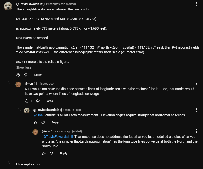
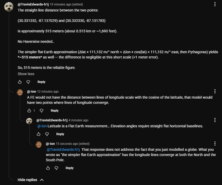
On 2026-03-18, TravisEdwards-h1j (suspected to be a sock puppet of DamascusSteel) used Δlat × 111,132 m/° north + Δlon × cos(lat) × 111,132 m/° east
as a simpler flat-Earth approximation
to calculate a distance on the planet.
According to his math, the distance between lines of longitude scales by the cosine of the latitude which is zero at both the North Pole and the South Pole. Therefore, lines of longitude converge at the poles. This describes a globe.
File history
Click on a date/time to view the file as it appeared at that time.
| Date/Time | Thumbnail | Dimensions | User | Comment | |
|---|---|---|---|---|---|
| current | 04:52, 18 March 2026 | | 851 × 709 (63 KB) | Ion (talk | contribs) | On 2026-03-18, TravisEdwards-h1j (suspected to be a sock puppet of DamascusSteel) used <q>Δlat × 111,132 m/° north + Δlon × cos(lat) × 111,132 m/° east</q> as a <q>simpler flat-Earth approximation</q> to calculate a distance on the planet. According to his math, the distance between lines of longitude scales by the cosine of the latitude which is zero at both the North Pole and the South Pole. Therefore, lines of longitude converge at the poles. This describes a globe. |
You cannot overwrite this file.
File usage
The following page uses this file: