
File:Rowbotham map.jpg


Size of this preview: 604 × 600 pixels. Other resolution: 738 × 733 pixels.
Original file (738 × 733 pixels, file size: 124 KB, MIME type: image/jpeg)
Summary
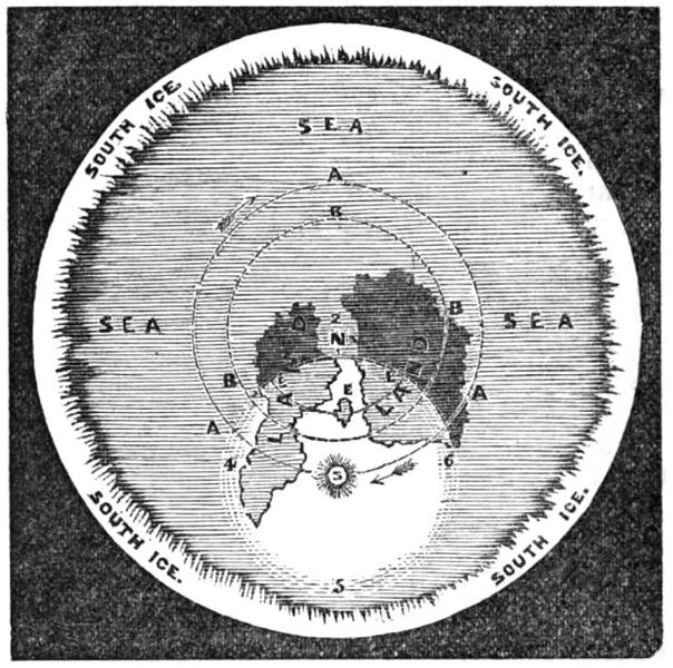
One of Samuel Rowbotham's maps, included in his 1865 book Zetetic Astronomy: Earth Not a Globe on page 78.
It accompanied this text:
In the following diagram A A A represent the Sun's daily path on December 21st, and B B B the same on June 15th. N the North Pole, S the Sun, E Great Britain. The figures 1 2 3 the Arctic Circle, and 4 5 6 the extent of sunlight. The arrows show the direction of the Sun's motion.
File history
Click on a date/time to view the file as it appeared at that time.
| Date/Time | Thumbnail | Dimensions | User | Comment | |
|---|---|---|---|---|---|
| current | 02:16, 1 December 2024 | | 738 × 733 (124 KB) | PeterMarkley (talk | contribs) | One of Wikipedia:Samuel Rowbotham's maps, included in his 1865 book [https://books.google.com/books?id=oTUDAAAAQAAJ ''Zetetic Astronomy: Earth Not a Globe''] on page 78. It accompanied this text:<blockquote>In the following diagram A A A represent the Sun's daily path on December 21st, and B B B the same on June 15th. N the North Pole, S the Sun, E Great Britain. The figures 1 2 3 the Arctic Circle, and 4 5 6 the extent of sunlight. The arrows show the direction of the Sun's motion.</blo... |
You cannot overwrite this file.
File usage
The following page uses this file:
